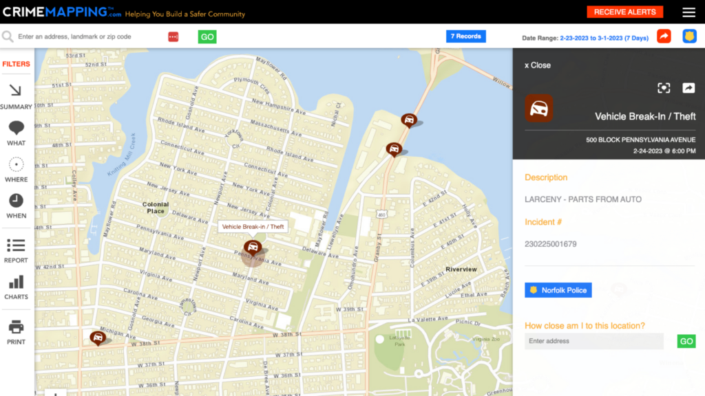


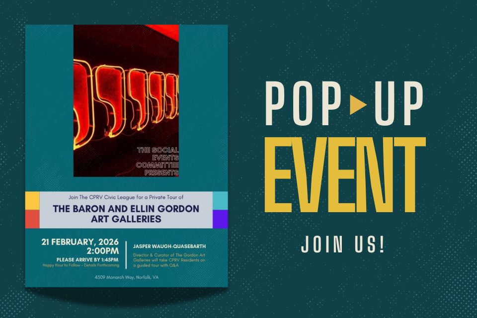
Private Tour of The Baron and Ellin Gordon Art Galleries | 2/21 @ 2 PM
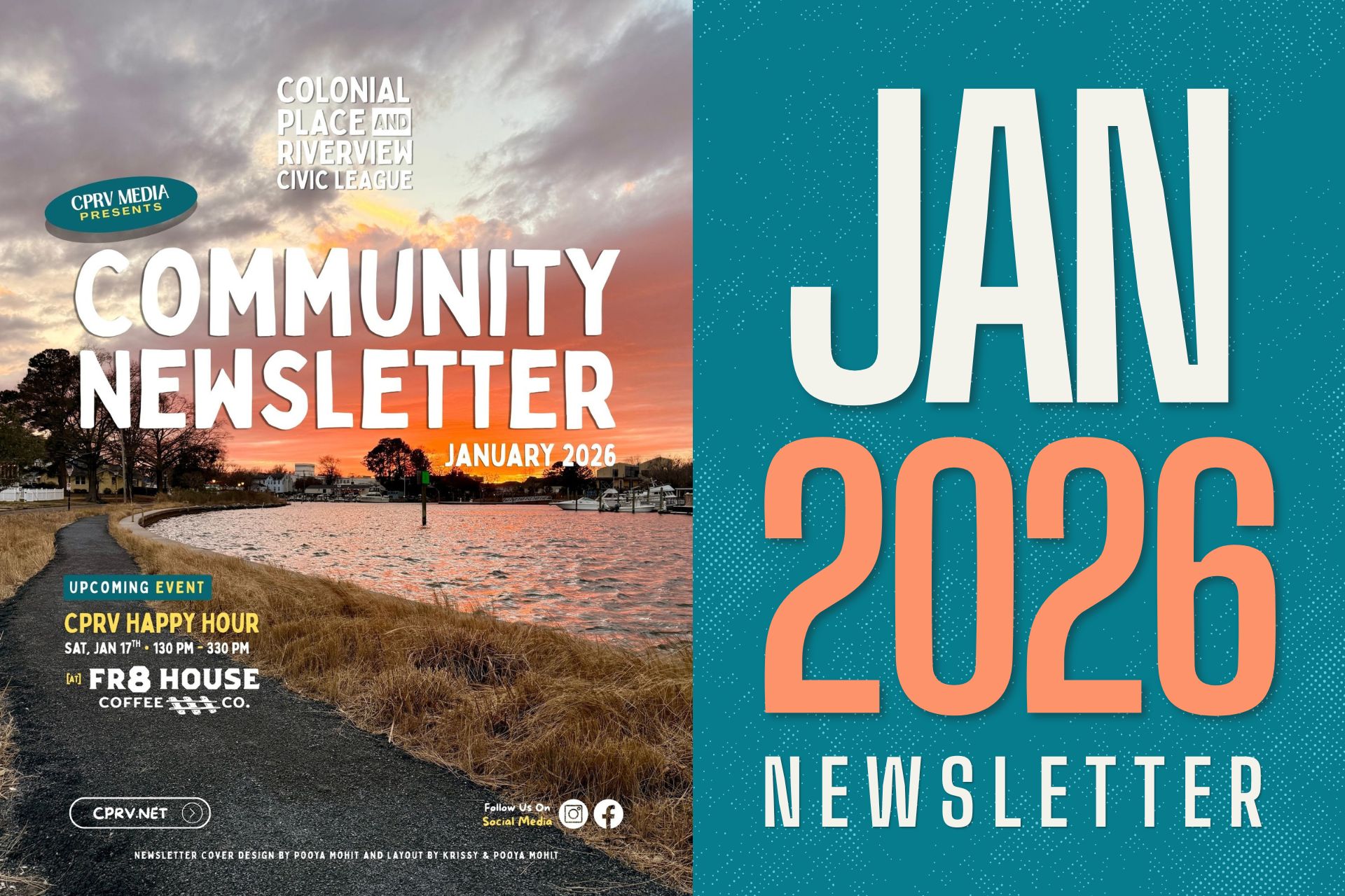
Explore what’s inside this month’s newsletter, including meeting highlights, community updates, features on gardening, sustainability, and composting, upcoming events, ways to get involved, and stories celebrating our neighbors and the shared efforts shaping CPRV.